blog content
Recent Posts

What's Happening in Rockport – May 2025
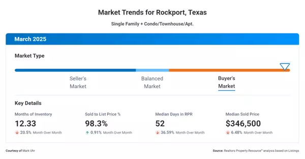
March 2025 Rockport Real Estate Market Update

Spring Home Maintenance Tips for Coastal Texas Homes
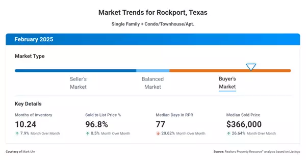
February 2025 Rockport Real Estate Market Update

How to Buy a Vacation Home in Rockport, TX: A Smart Investment or Coastal Retreat?
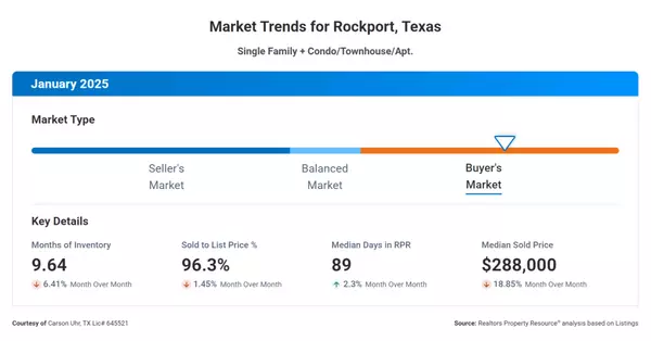
January 2025 Rockport Real Estate Market Update

Valentine’s Day in Rockport: Romantic Activities & Getaways for 2025
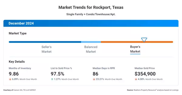
December 2024 Rockport Real Estate Market Update

Why Winter is a Great Time to Buy or Sell in Rockport, TX

New Year, New Goals: Why 2025 is a Great Year to Buy or Sell in Rockport, TX
We're here to help you find your dream home and ensure your selling experience is smooth and successful. Let our dedication and local expertise guide you through every step of your real estate journey.